TOPOGRAPHICAL INVESTIGATION CONDUCTED BY KERI PEECHI-ORGANISATION UNDER CHIEF ENGINEER-I&D-IDRB,THIRUVANANTHAPURAM
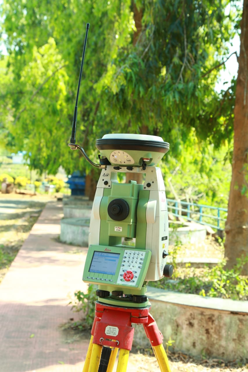
As a part of modernization of Kerala Engineering Research Institute (KERI), a Smart Station from Leica Geosystems has been purchased in the financial year 2013-14 . Smart Station is a new revolutionary surveying system in which high performance Total Station (TS11) and a powerful GNSS Receiver (GS14 satellite receiver) are perfectly integrated. The main components of Smart Station are Base station GNSS and Smart Antenna, RTK Rover GNSS with Pole, Antenna and CS10 Field Controller (Smart Pole) and Total station with back sight Tripod kit.
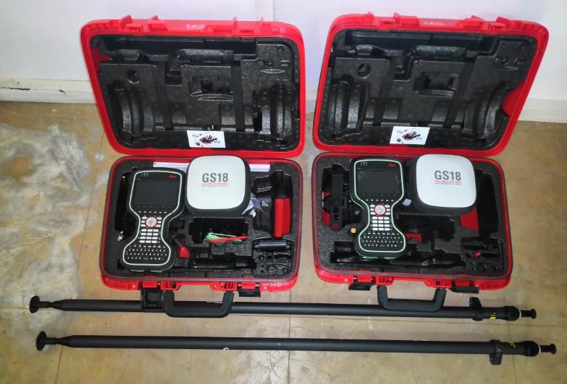
Leica GS14 has been upgraded to Leica GS 18 T model. Leica GS 18T is the world’s fastest GNSS RTK rover and is a part of the Leica Geosystems self-learning GNSS series with advanced signal tracking technologies. With more constellation and L band, GS18T will have more satellites in canopy area. GS18T is fitted with IMU based tilt sensor, so that no magnetic field can affect the positioning. This can work close to bigger concrete structures with larger reinforcement, Electrical installations etc. Due to the tilt compensating function, it is not required to hold the survey pole in vertical position, that is there is no need to level the bubble for measuring and staking of points. In this the sensor accurately and reliably measures the pole tilt and together with RTK or Smart Link, provides an accurate tilt compensated position. There is savings up to 20 per cent over conventional surveying practices due to the fact that no time is wasted by levelling the bubble. The IMU-based tilt-compensating RTK is applicable at large tilt angles of more than 30 degrees, where a 3D positioning accuracy of 2 cm is still achievable.
Leica GS 18T is integrated with a new Cinterion cellular modem that supports LTE (4G) as well as all existing networks. In Leica GS 18T a self-learning GNSS sensor is being used, hence the best satellite signals and the best available correction data is chosen automatically thus achieving best possible position accuracy and quality. SmartLink and SmartLink fill are precise point positioning services that enable the sensor to provide precise measurements when the RTK correction service is unavailable. By incorporating sensor heading into 3D visualisation of the surroundings, the user can easily orientate himself in the surveying environment, which improves productivity and user experience. The measurement engine in GS 18T is ME7 (measurement engine generation 7). This gives an ultimate performance in GNSS positioning.

TotalStation with GNSS Receiver (SmartStation)

GS-18 T BASE/ROVER

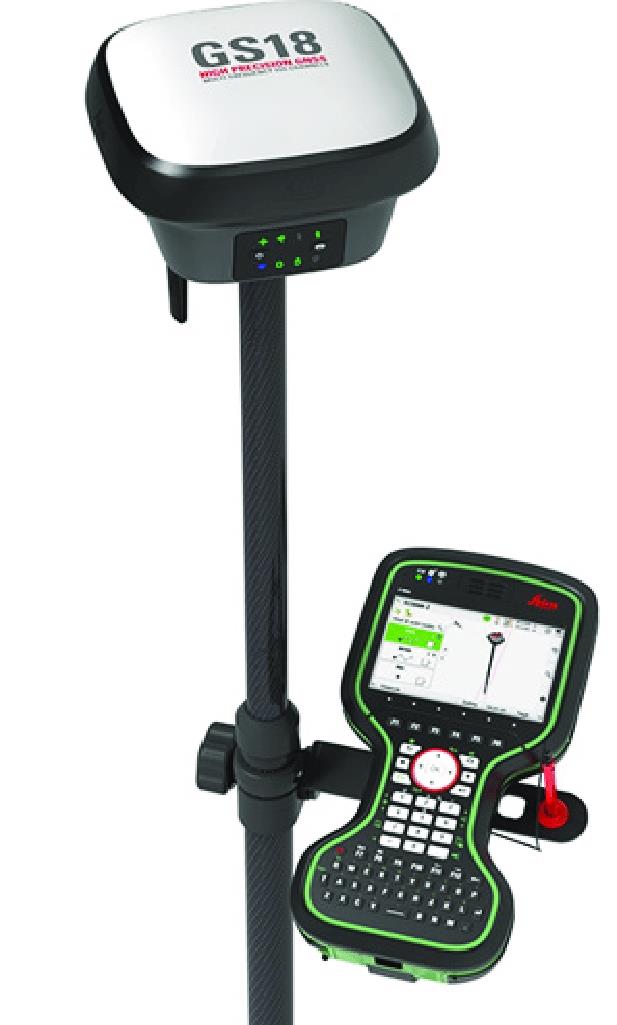
Leica GS18 T GNSS RTK rover with CS20 field controller.
It includes latest features such as 555 channels, Multi-frequency, Multi constellation, L-band service etc. This allows tracking more satellites conpared to GS14 in parallael channels. This sensor is supplied with most modern controller of Leica CS20 with specialized package software called Captivate. Captivate is the most field worthy software in the industry with more land survey features compared to CS10 controller.
Methodology of Survey
RTK surveying is a relative positioning technique which measures the position of two GNSS antennas relative to each other in real-time.
Satellite Ranging
All GPS positions are based on measuring the distance from the satellites to the satellite receiver on the earth. This distance to each satellite can be determined by the receiver. The basic idea is that of resection. If distance to three points relative to our own position is known, our position relative to those three points can be determined. From the distance to one satellite we know that the position of the receiver must be at some point on the surface of an imaginary sphere which has its origin at the satellite. By intersecting three imaginary spheres the receiver position can be determined. The problem with GPS is that only pseudo ranges and the time at which the signal arrived at the receiver can be determined. Thus there are four unknowns to determine; position (X, Y, Z) and time of travel of the signal. Observing to four satellites produces four equations which can be solved, enabling these unknowns to be determined. GS 18-T satellite receiver can track signals from GPS satellite constellation having 24 satellites (L1, L2, L2C, L5), Glonass satellite constellation having 24 satellites (L1, L2, L32), BeiDou (B1, B2, B32), Galileo (E1, E5a, E5b, Alt-BOC, E62), QZSS (L1, L2, L5), NavIC L53, SBAS (WAAS, EGNOS, MSAS, GAGAN), L-band etc.
Reference Receiver/ Base station
The Reference receiver antenna is mounted on a previously measured point with known coordinates. The receiver that is set at this point is known as the Reference Receiver or Base Station. The receiver is switched on and begins to track satellites. Because it is on a known point, the reference receiver can estimate very precisely what the ranges to the various satellites should be. The reference receiver can therefore work out the difference between the computed and measured range values. These differences are known as corrections. The reference receiver is usually attached to a radio data link /Multiband GSM/UMTS/LTE which is used to broadcast these corrections.
Rover Receiver
The rover receiver is on the other end of these corrections. The rover receiver has a radio data link /Multiband GSM/UMTS/LTE attached to it that enables it to receive the range corrections broadcast by the Reference Receiver. The Rover Receiver also calculates ranges to the satellites. It then applies the range corrections received from the Reference. This lets it calculate a much more accurate position than would be possible if the uncorrected range measurements were used. Using this technique, all of the error sources of satellite signal transmission such as Ionospheric and atmospheric delays, Satellite and Receiver Clock Errors, Multipath Dilution of Precision Selective Availability (S/A) Anti Spoofing (A-S) are minimized, hence the more accurate position. It is also worthwhile to note that multiple Rover Receivers can receive corrections from one single Reference.
With SmartStation, there is no need of control points, traverses and resections. Just set up wherever it’s convenient and within a few seconds, RTK determines the position to centimetre accuracy at ranges up to 25 km from a reference station.


